New satellite imagery shows how Burma’s military is torching villages
AI Overview
Summary is AI-generated, newsroom-reviewed.
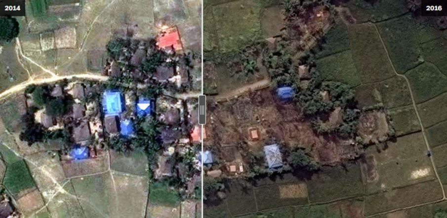
Over the past three weeks, Human Rights Watch has identified three villages in Burma’s Rakhine state that have been all but completely burned, presumably by the military. Before-and-after satellite imagery depicts about 430 buildings reduced to ash, along with the tree cover surrounding them.
Read the full article for more on:
- Important insights and detailed analysis
- Expert commentary on current events
- Breaking developments and updates
New satellite imagery shows how Burma’s military is torching villages
SOFREP News Team
Speed
1x
Over the past three weeks, Human Rights Watch has identified three villages in Burma’s Rakhine state that have been all but completely burned, presumably by the military. Before-and-after satellite imagery depicts about 430 buildings reduced to ash, along with the tree cover surrounding them. Rakhine state has experienced recent violence stemming from a much-longer conflict between ethnic […]
Advertisement
What readers are saying
Generating a quick summary of the conversation...
This summary is AI-generated. AI can make mistakes and this summary is not a replacement for reading the comments.


COMMENTS