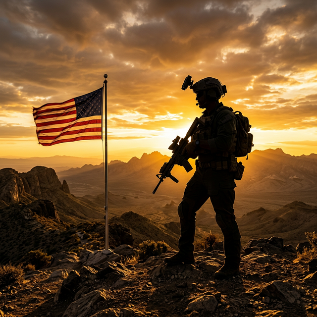
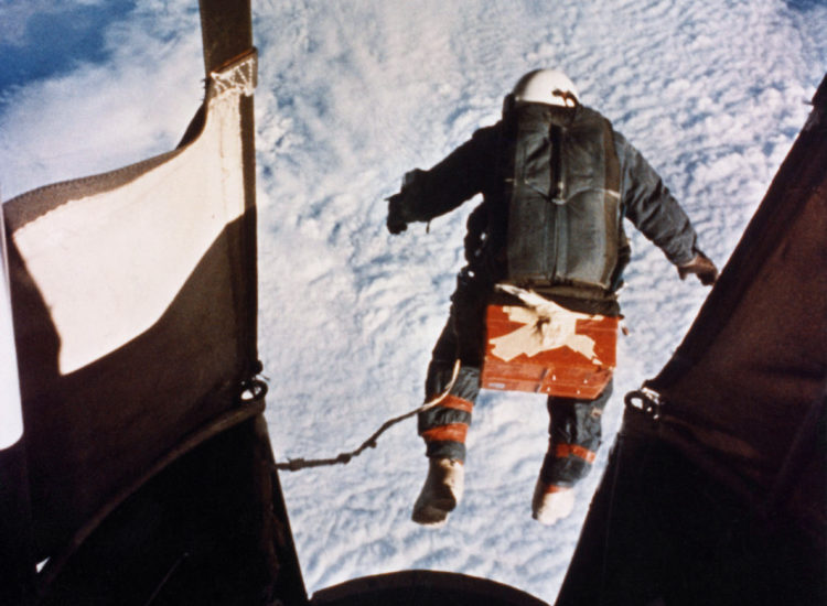
Out we went.
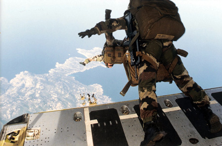
Every Man for Himself
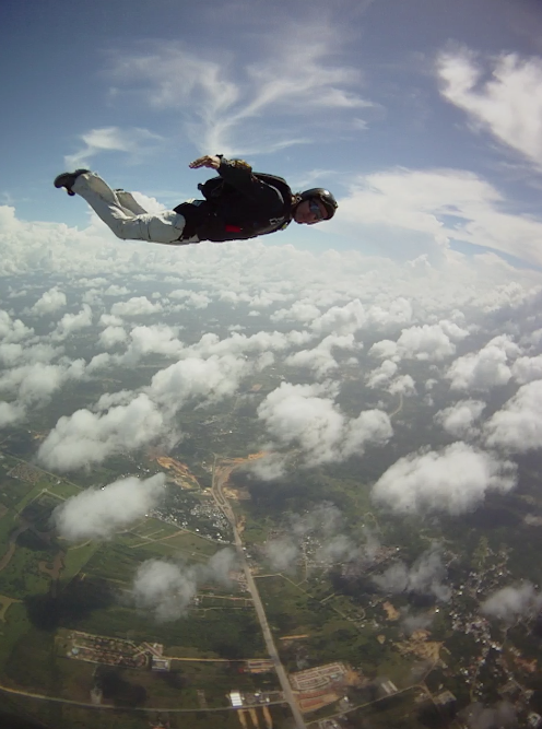
Over the cloud deck, I did see a modest opening and some ground, but not enough ground to be able to orient myself and track in an appropriate direction. So I just fell straight down. Brother Sam Booth Foster flew up to within a couple of feet from the tip of my nose with a puzzled expression and shrugged his arms and shoulders. I shrugged back: “Yeah, IDK WTF we are, Sam!” He turned and flew off to the next brother.
When I broke through the status layer, nothing on the ground below looked familiar. I slowly turned 360 degrees in an effort to spy a familiar feature, but I spied none, and I was already under 5k feet AGL—time to start my pull sequence. Under the canopy again, I turned another 360. I recognized nothing and spied none of my brothers. Everyone had gone to “sauve qui peut” mode—every man for himself.
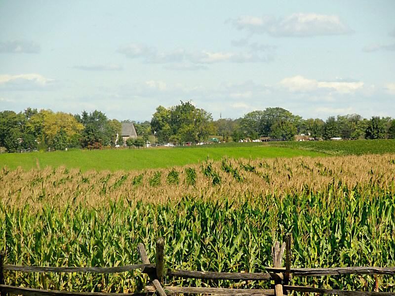
With all the annoying $hit past me, it was time to pick a place to land. It impressed on me that landing would be easy enough; the setting was rural with largely deserted expanses and cultivated fields. My final decision for a touchdown location teetered between two cornfields. I decided to flip a coin, which I immediately fumbled and dropped, hurtling it to the Earth below. Parachuting, as it turns out, is no time for a fine motor neuron operation.
My advanced Delta Force training pointed me to an alternate selection solution. I alternated my pointing finger between the two fields:
“Eeny-meeny, miney-moe… catch a sailor by the toe… if he hollers make him pay…”
Altitude ran out, and I was forced to choose my landing point without the aid of mental tools. Sinking toward the cornfield, I briefly wondered how many times it had changed hands in battles during the Civil War.
A hard flare, and it was over. I stood alone in an empty cornfield:
“…fifty dollars every day.”
T’was apparent that the Jumpmaster, though meaning quite well, went overly ambitious in his desire to get his jumpers out in time. The result was that he imagined the small sample of terrain below to be more familiar than it was in reality. Standing safely on the ground, I quietly forgave him, though I cursed and damned every atom of his being many times on my unfamiliar plunge to Earth.
A New Friend
As I bagged my parachute, I heard the crunch of tires on the gravel road at the edge of the field. I looked up to see a tremendous battleship of an early model Chevy, an Impala, I think it was, stop just there, and a rustic brother-man in his 50s step out:
“I seent-cha a-coming down.” He said, switching a toothpick from one corner of his mouth to the other.
“Good day, Sir. Are you the owner of this field? I’m really sorry about this; it was by total accident that we landed here, aha.”
“We?”
Looking around, I realized that I hadn’t seen any of the other brothers since I broke through the clouds.
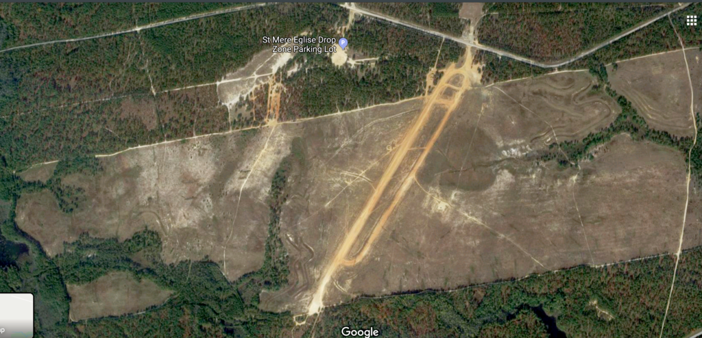
“Well, Sir… there were eight of us that all jumped together. We lost each other in the clouds. Did you see any other parachutes besides mine? We were trying to land on Sainte Mère Église parachute landing field, Sir.”
“I been livin’ here pritt’n’eer all ma life, and I ain’t NEVER heard a no Saint Mary’s Glee. I reckon you’ll be needing a ride.”
“Oh, hey, yeah! I would appreciate a ride to a 7-11 where I can get on a phone back to my people!”
The brother-man even tried to lift my parachute kit bag for me after he popped his trunk. I crowded him and lifted my bag myself profusely, thanking him just the same. Not knowing how long the drive would be, I made small talk. I tried to keep it simple, so I talked about… crops:
“Yessirree it’s them danged little-ol’ root worms gets in ma corn and plumb ravages it — I hate them critters.”
“I hear you brother-man, if I had a root worm with me right now, I’d… why I’d punch it in the fuckin’ face!”
So it went.
At some point before the 7-11, I observed a sterile van, which caught my eye, approaching. As it passed, I could see several pipehitters staring back at me as the van went into an immediate breaking solution:
“Brother-man, those are my people that just passed. They saw me and are stopping — can you just kick me out right here?”
Cool Hand Geo
The van had flipped a bitch and was chugging up just behind us as I yanked my chute from the trunk. I didn’t break away so fast, wanting to seize the moment for some proper thanks to brother-man for interrupting his routine for me. After a genuine handshake and pat on the shoulder, I grabbed my kit and climbed into the van, where seven grins waited to hear my fraction of the day’s adventure.
“Ok, so, Geo?”
“Landed in that guy’s cornfield, me I did.”
“Yeah, we all pretty much landed in cornfields.”
“Ah, were they Union or Confederate cornfields?”
“Now, why you always feel compelled to make reference to the Waw-ah of Nawthern Aggression like that?
“Ohhh… what we got here is a failure to communicate, Cool Hand Geo!”
“Let me tell you why you yokels lost that war…”
“What do you mean lost that war, and who y’all callin’ a yokel?”
And so it went.
By Almighty God and with honor,
geo sends
—
— Editor’s Note: Let’s all do Geo a solid. Go out and buy his book and visit his website. I promise it’s all good stuff. — GDM


COMMENTS