So, you’ve volunteered to be in Special Forces and you’re getting ready to go to Special Forces Assessment and Selection (SFAS). This is the time to prepare yourself for the grind that is to come. There are certain tips, such as the PT program which will help you attain the level of physical fitness that you’ll need to not just pass the course but to excel where the course isn’t as tough as you’ll see other people struggling.
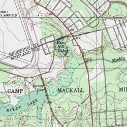
Now, we get to the elephant in the room, the Land Navigation course and many students fail at either SFAS or the SFQC because they failed the land navigation course. The course is tough, it is the toughest individual land navigation course you’ll find in the US military.
In previous segments, we touched on Map reading, pace count, orienting the map and plotting your starting location. Now we’ll get into the plotting and planning of your route. A proper plan makes getting there a heck of a lot easier.
Plot Your First Point: Okay in our previous segment, we’ve checked and then double-checked our location so that you know exactly where you are starting from. Now you plot your first point the exact same way.
Read to the right and up and using the 1/50,000 map scale, carefully plot your eight-digit grid coordinate to where you are going. Remember, four-digit grids get us to within 1000 meters, six-digit grids to within 100 meters and an eight-digit grid gets us to within 10 meters. Double check your plot and ensure you’ve got it right.
Now measure the distance between the two points. Remember this is straight line distance and not walking distance. Your actual traveling distance will vary from point to point depending on your route selection and the terrain that you’ll encounter.
Planning the Route: There are two basic ways you can get to where you’re going. Either will get you to where you’re going but for your purposes in SFAS, one may prove to be a better option. Again, don’t go with what everyone else is doing, always do what is right for you.
Dead Reckoning – Is a system that is done in two steps. The first is getting an azimuth from your starting point using your map and protractor and determine the distance to where your point is located at. The next step is to use your compass and your pace count and apply what you’ve already learned and walk to your point by staying as close as you can to your azimuth.
Your position can be checked from time to time using both resection or intersection when the terrain features are available. Dead Reckoning has some advantages; it is easy to teach the neophyte navigator and in open terrain, especially in grassy areas or desert type regions, it is easier to stay on the azimuth. It works well also when the distances to be covered are short.
A distinct disadvantage of this method is when you’re facing the terrain you’ll be subjected to in the Hoffman area. Thick vegetation, intermittent streams, draws and swampy areas make Dead Reckoning a dicey proposition. However, it can and does work. I know several SF guys who plowed thru the Land Nav course using this exact method. I wouldn’t recommend this but it can be done at times and will work. But perhaps the second method is the better way to go.
Already have an account? Sign In
Two ways to continue to read this article.
Subscribe
$1.99
every 4 weeks
- Unlimited access to all articles
- Support independent journalism
- Ad-free reading experience
Subscribe Now
Recurring Monthly. Cancel Anytime.
Terrain Association – Is a bit more difficult to plan but is much less forgiving of mistakes and as a rule a helluva lot less time-consuming than Dead Reckoning. It requires a more detailed map study of where you’re going and how you plan to get there but the time spent planning your movement is better served than trying to plow your way thru the draws.
The advantages of terrain association are obvious. If you veer off course in Dead Reckoning, you are in trouble. But using terrain association, your position is easily checked and adjustments made on the fly.
Selection and identification of terrain features are key here. Plan your route using handrails as a guide and ensure to plot checkpoints along the way. Ensure your map is oriented and use the available terrain as a guide. You won’t be following a specific azimuth per se, but more of a cardinal direction to your checkpoints using your map to guide you.
You can use the roads both the improved and the unimproved as a guide but the best advice is DON’T BREAK THE RULES! Parallel the roads but not too closely. Make sure that plot a backstop on your route that you can identify as having gone too far.
A word of caution about the roads in Hoffman. There a lot of them out there, and many are not on the map. While there are exceptions…You’ll become familiar with “Five Points” but for the most part, those are at times difficult to judge. Just be careful.
Always remember and the instructors will drill it into your head, that if you come upon a hardball road. Stop. You won’t be crossing any of those in the course but a few of the points may be near them so you can use those as a handrail at times.
But surer than the national deficit going up, someone in your class is going to cross a hardball road. It used to happen in every class and don’t be surprised to hear about it from the other students. Just don’t be “That Guy”.
Plot checkpoints along the way to ensure that you are on track and on target. Choose an attack point that will put you no farther than 200-300 meters from your point. When you arrive there, that is the time to use dead reckoning and plot an azimuth to your point.
We’re almost ready to head out and attack the course. Remember everything you learned and the best advice is to practice, practice and practice some more. The more comfortable you are using your map, compass, and skills at terrain association now, the easier the course will be for you.
In our next segment, we’re heading to Hoffman.
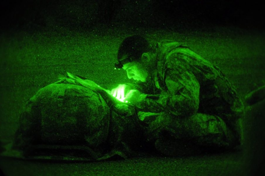
Photo courtesy of DOD


COMMENTS