We’ve been going back over some of the basics in recent weeks as the winter months means an entirely new batch of Selection classes and candidates. And many of the new candidates have questions, just like the last group of prospective Special Operations troops did and we’ll do our best to answer every one of them.
There are always concerns, fears and questions about the Land Navigation course and many students fail and frankly, they fail because they are psyched out at the very beginning either during SFAS or the SFQC. Look, as we’ve said many times, the land navigation course is no joke. It is tough, it is the toughest individual land navigation course you’ll find in the US military.
But once again, and we can’t stress this enough. Thousands of guys before you have passed the course and although it is tough, it is far from impossible. It just takes keeping your wits about you, learning basic skills and practice. If you are a new person in the military or are a junior NCO but hold an MOS where you didn’t spend a lot of time in the field with a map and compass, then these quick refresher pieces are perfect for you.
Land Navigation is one of those skills that while it isn’t hard to learn the basics, mastering them takes practice. And the more you know about it going in, the odds of your being selected go up markedly.
In previous segments, we touched on Map reading and the importance of your pace count. Now we’ll move on to the next step in finding your way around Hoffman. That begins with orienting your map and then plotting your start point on the course.
Prior to Starting Out:
Orient the Map – This makes map reading and using the available terrain features much easier to read. What does it mean to have the map oriented? The schoolbook answer is: A map is oriented when it is in a horizontal position with its north and south corresponding to the north and south on the ground. If that is as clear as mud, to the average Joe, it means when you’re holding the map in front of you, the terrain matches up exactly as it is shown on the map.
It makes it much harder to try to read your terrain features upside down or sideways. If you are using an Army lensatic compass, remember that a compass measures magnetic North. So, don’t forget to check your declination diagram which is located on your marginal information at the bottom of your map. Most military issue maps take the guess work right out of it and tell you how to convert the declination of azimuths from grid to magnetic and from magnetic to grid next to the declination diagram.

While it sounds quite simple, many people mess this up and start off on the wrong foot. Don’t be Ned the Navigator. Ned the Navigator was the example we used in every SFAS class. He knew all about Land Nav and we were wasting his time with the refresher classes at Selection. He knew it all. Guess who was the first guy that got lost? So, take your time and do it right the first time.
With the map in a horizontal position, take the straightedge on the left side of the compass and place it alongside the north-south grid line with the cover of the compasspointing toward the top of the map. This procedure places the fixed black index line of the compass parallel to north-south grid lines of the map.
Keeping the compass aligned as we said in the last paragraph, rotate the map and compass together until the magnetic arrow is below the fixed black index line on the compass. You’re almost…. But not there yet!
Already have an account? Sign In
Two ways to continue to read this article.
Subscribe
$1.99
every 4 weeks
- Unlimited access to all articles
- Support independent journalism
- Ad-free reading experience
Subscribe Now
Recurring Monthly. Cancel Anytime.
Now rotate the map and compass in the direction of the declination diagram.
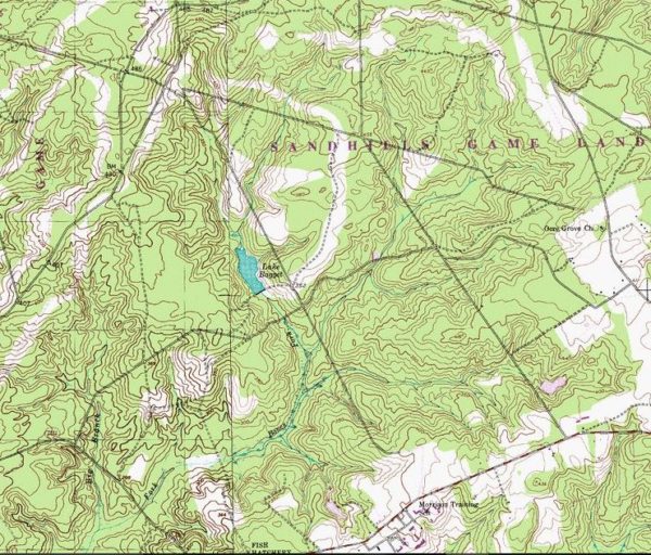
If the magnetic north arrow on the map is to the left of the grid north, check the compass reading to see if it equals the G-M angle (if memory serves me well it is 8 degrees for the Hoffman area) given in the declination diagram. Voila! The map is now oriented. Take your time and try to pick out the terrain features as they lay out in front of you. Just be advised, in the Hoffman area, the terrain features aren’t as distinct and are a bit harder to distinguish. That’s why you’ll always hear from the cadre and it is true, that if you can navigate with ease in Hoffman on the “Star” course, you will be able to navigate just about anywhere.
In certain areas, you’ll be able to orient your map just by using terrain features. And when the terrain allows, it is quicker and easier to navigate using the available terrain. If you’ve ever navigated in the mountains, you’ll find this is much easier and you’ll find that this way is much preferable than dead reckoning. And it definitely comes in handy when having to call for fire in a jiffy… (that is a class for another time perhaps)
Creating a Start Point – Now the map is oriented in the direction that you’re going to be walking and the next thing is you must create a starting location. The starting point is where you are standing at. Now pull out your handy, dandy Army protractor. But wait.
Don’t lose your protractor, in case you didn’t get that, let me repeat. DON’T LOSE YOUR PROTRACTOR! Always keep it secured inside your map case until you need it and ensure it is in there before taking off and hitting your points, especially at night! Nothing worse than losing a protractor during land navigation. While you can get by without one, it makes things unnecessarily much harder. So, take the few seconds to check.
Now read the grid lines to the right and up and make sure that you’re using the 1/50,000 scale for the map, which is in the upper right corner of the protractor. That will automatically ensure that the protractor is facing the right way and isn’t flipped over.
Remember a four-digit grid, gets you to within the grid square or 1000 meters. A six-digit grid gets you to within 100 meters and an eight-digit grid gets you within 10 meters. A good rule of thumb to remember is to forget about where the plastic is cut out of the protractor. Always align the 0’s and check it twice. Ensure you plot it twice to get the exact spot.
Now we have a starting point, that is right where you are standing, but don’t bother shaking a tree, it won’t move on the map. Don’t laugh someone falls for that old one all the time.
So, we have our map oriented and our starting point plotted. This is where it gets interesting and where we get our navigation from Point A to Point B started. This is the easy part but regardless, practice doing this until it becomes second nature and is there is never a doubt on how to do it. Are we all set? Are you sure??? Do it again.
Next up in one of our future posts we’ll look at plotting and planning a route.
Photo courtesy DOD


COMMENTS